| [1] |
徐晓梅, 王军农. 青海湖流域水文要素初步分析[J]. 科学技术与工程, 2012, 12(29):7669-7673.
|
| [2] |
彭红明, 许伟林, 何青, 等. 布哈河流域中上游地区水文地球化学与同位素特征[J]. 干旱区研究, 2015, 32(5):1032-1038.
|
| [3] |
罗利川, 梁杏, 李扬, 等. 基于GMS的岩溶山区三维地下水流模式识别[J]. 中国岩溶, 2018, 37(5):680-689.
|
| [4] |
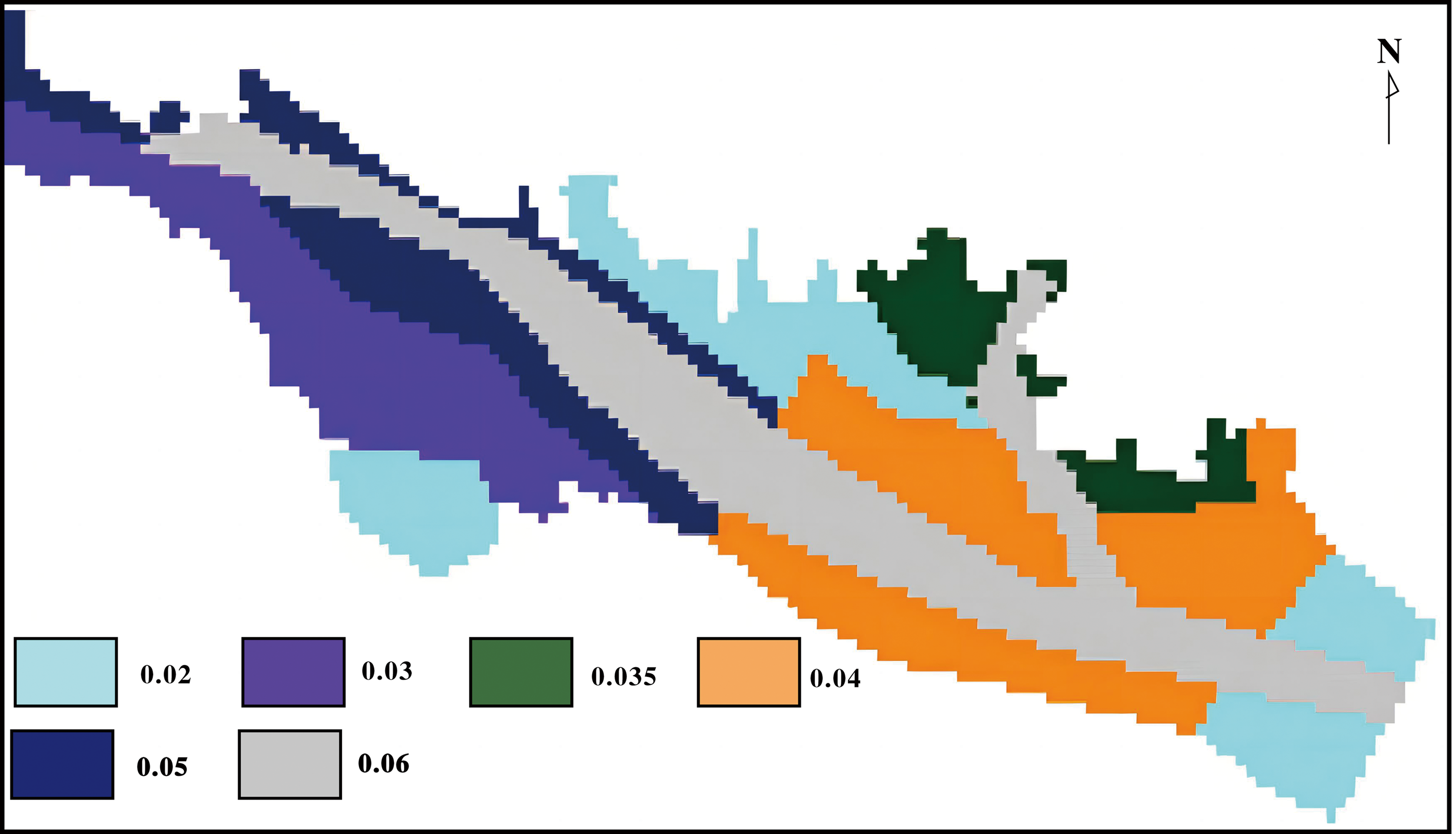
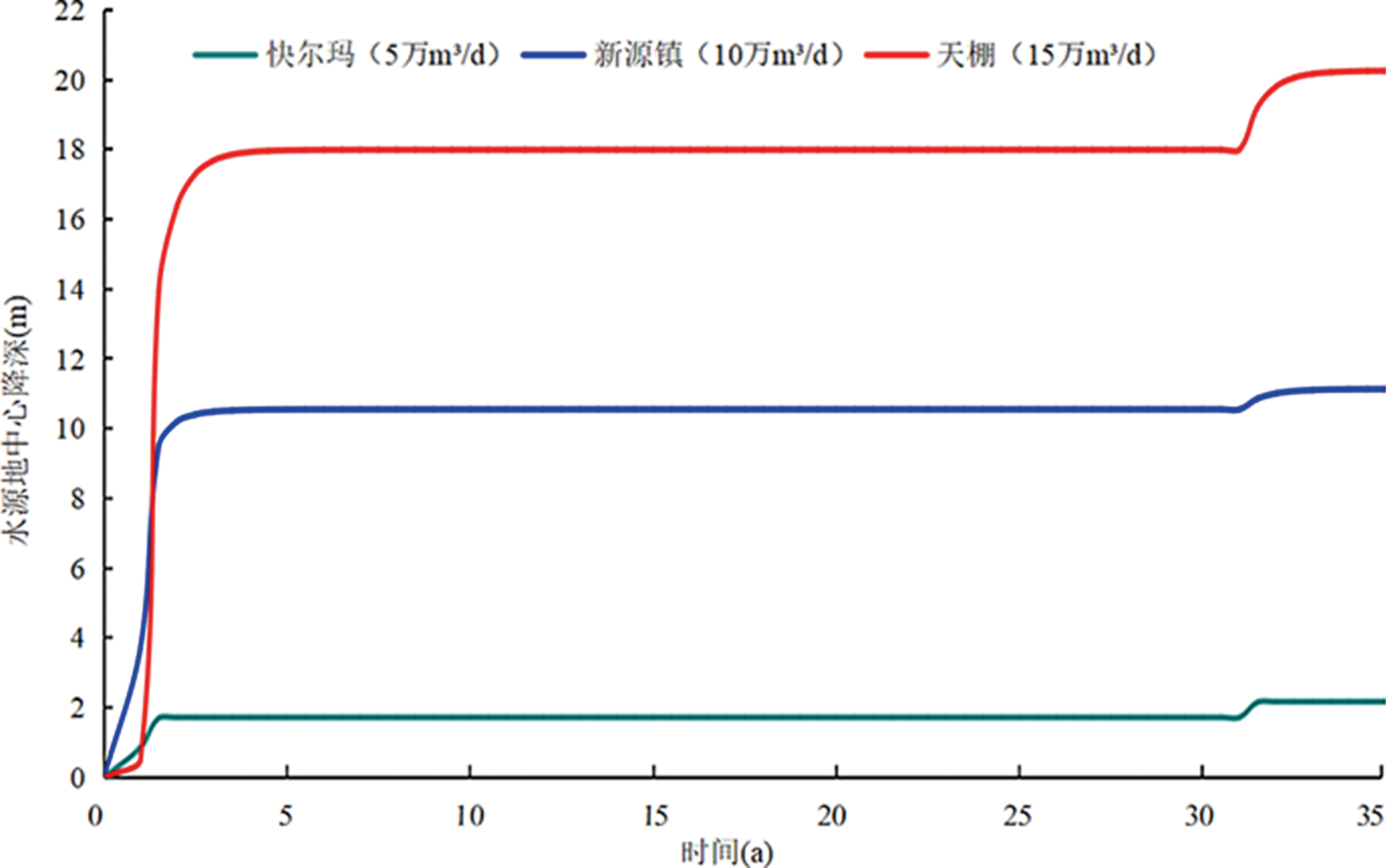
陈陆望, 何建东, 施小平, 等. 松散承压含水层水文地质参数分区及水流场数值模拟[J]. 现代地质, 2015, 29(4): 967-974.
|
| [5] |
孙倩, 邵景力, 崔亚莉, 等. 基于三维随机水文地质结构模型的地下水流数值模拟:以西辽河平原为例[J]. 现代地质, 2019, 33(2): 451-460.
|
| [6] |
周念清, 朱蓉, 朱学愚. MODFLOW在宿迁市地下水资源评价中的应用[J]. 水文地质工程地质, 2000, 27(6): 9-13.
|
| [7] |
王平, 黄爽兵, 韩占涛, 等. 基于溶质运移模拟的某化工场地污染物对拟建水库污染风险预测[J]. 现代地质, 2015, 29(2): 307-315.
|
| [8] |
单晓杰, 何江涛, 张小文, 等. 基于人为活动影响识别的区域地下水水质演化预测:以石家庄地区为例[J]. 现代地质, 2020, 34(1): 189-198.
|
| [9] |
崔瑜, 吴泰然, 周磊, 等. 基于数值模拟的再生水对地下水质影响实例[J]. 地质通报, 2018, 37(7):1365-1373.
|
| [10] |
郭帅, 周训, 吴旸, 等. 模拟温泉形成的一种管道渗流实验[J]. 现代地质, 2012, 26(3): 620-626.
|
| [11] |
左伟, 刘运涛, 李建林, 等. 基于Modflow和时间序列法的汝州市温泉镇地热可开采量预测[J]. 河南理工大学学报(自然科学版), 2021, 40(5):56-62.
|
| [12] |
魏永霞, 唐仲华, 左霖. 数值模拟在地热资源评价及优化开采方案的应用研究[J]. 安徽地质, 2019, 29(1):74-80.
|
| [13] |
豆惠萍, 陈新海, 周秋成, 等. 平衡采灌条件下热恢复及热可采模拟研究:以任丘地区馆陶组砂岩热储为例[J]. 工程勘察, 2021, 49(8):39-45.
|
| [14] |
RASHID H, AL-SHUKRI H, MAHDI H. Optimal management of groundwater pumping of the cache critical groundwater area, Arkansas[J]. Applied Water Science, 2015, 5(3):209-219.
DOI
URL
|
| [15] |
GOSWAMMI D, KALITA P, MEHNERT E. Modeling and simulation of baseflow to drainage ditches during low-flow periods[J]. Water Resources Management, 2009, 24(1):173-191.
DOI
URL
|
| [16] |
周一飞, 陈慧颖, 张淑兰, 等. 基于SWIM模型模拟气候变化对青海湖布哈河流域水文过程的影响[J]. 北京师范大学学报(自然科学版), 2017, 53(2):208-214.
|
| [17] |
龙银平, 张耀南, 赵国辉, 等. SWAT模型水文过程模拟的数据不确定性分析:以青海湖布哈河流域为例[J]. 冰川冻土, 2012, 34(3):660-667.
|
| [18] |
王海妹, 李东, 雷雨, 等. Topmodel在布哈河流域径流模拟中的应用[J]. 水利科技与经济, 2016, 22(9):8-12.
|
| [19] |
李近虎, 邵玉红, 汪青春. 青海省E601B型蒸发与小型蒸发观测资料的对比分析[J]. 青海科技, 2006, 13(3):52-55.
|
| [20] |
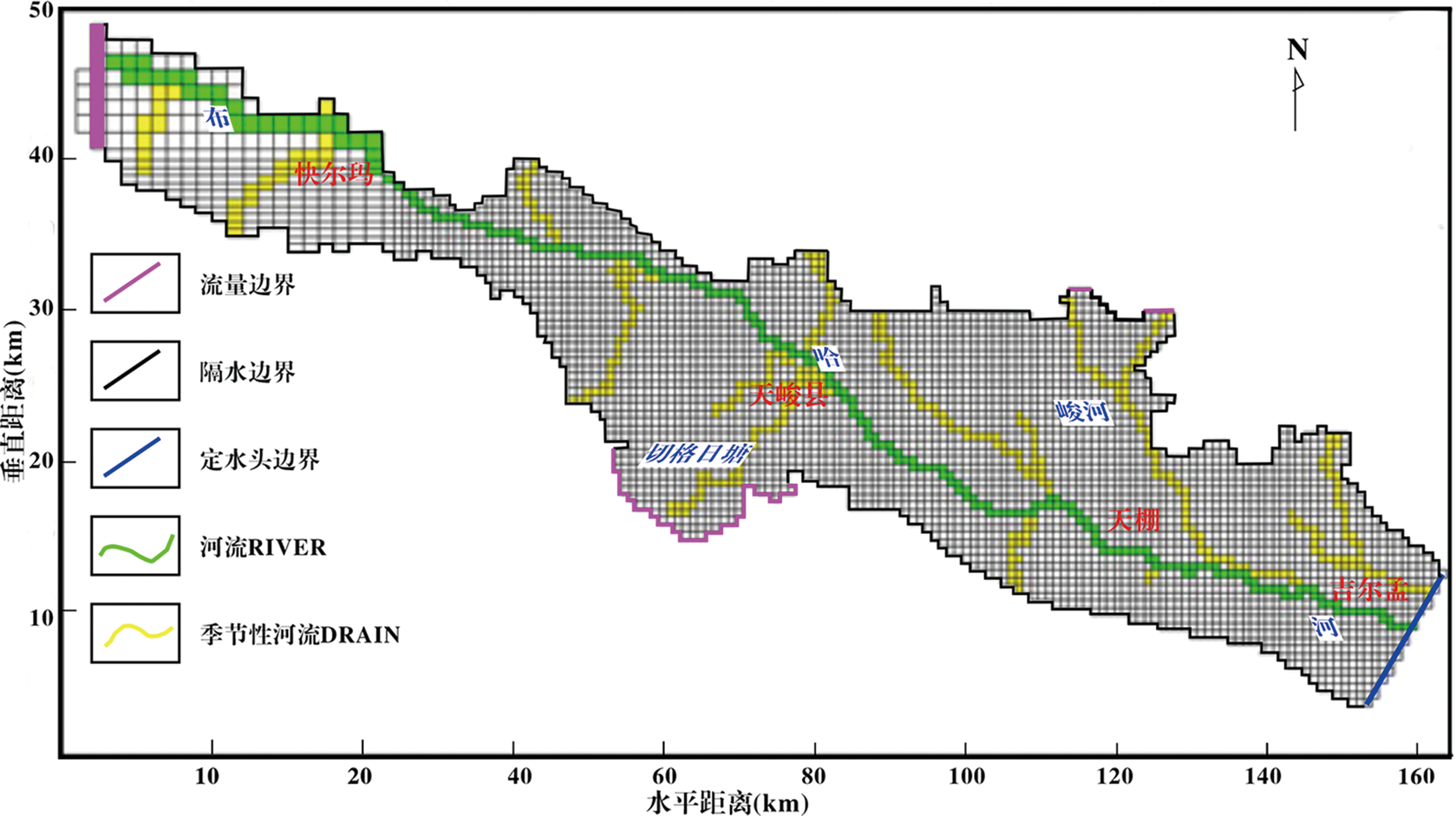
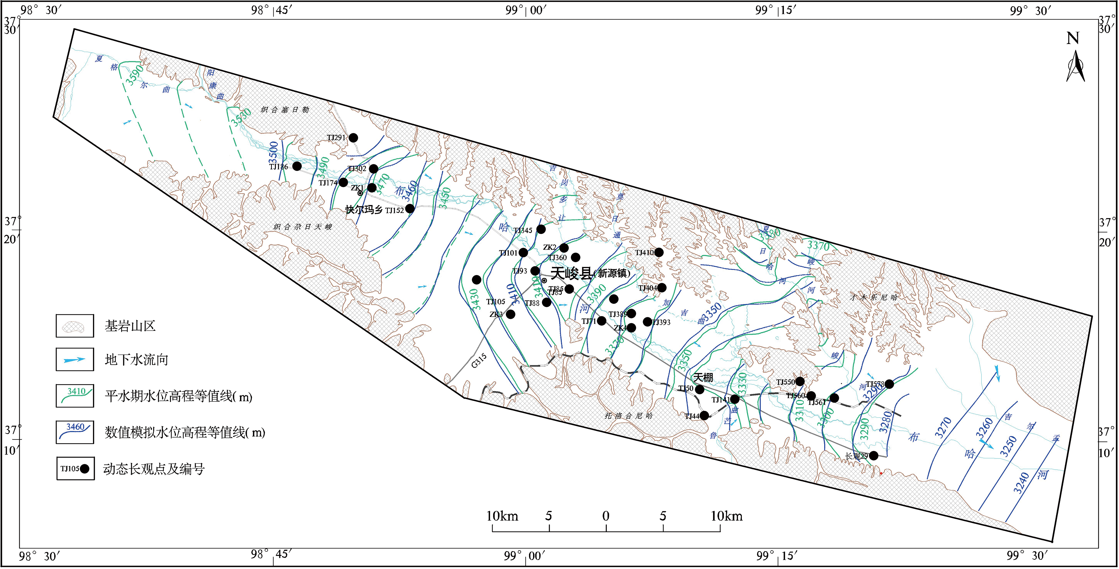
彭红明, 许伟林, 袁有靖, 等. 青藏高原柴达木盆地重点地区水文地质环境地质调查(天峻县)报告[R]. 西宁: 青海省环境地质勘查局, 2013.
|
| [21] |
赵家绪. 托素湖幅J-47-25 1/20万区域水文地质普查报告[R]. 格尔木: 青海省柴达木综合地质勘查大队, 1992.
|
| [22] |
水利部黄河水利委员会. 黄河流域及西北诸河水资源综合规划[R]. 郑州: 水利部黄河水利委员会, 2008.
|
 ), 王占巍3, 罗银飞4(