

Geoscience ›› 2017, Vol. 31 ›› Issue (05): 965-977.
• Research on the Main Geohazards and Engineering Geological Problems Along the SichuanTibet Railway • Previous Articles Next Articles
LIU Xiaoyi1,2( ), YANG Zhihua1,3(), GUO Changbao1,3, SHEN Wei2, SU Fangrui2
Received:2016-10-12
Revised:2017-05-10
Online:2017-10-10
Published:2017-11-06
CLC Number:
LIU Xiaoyi, YANG Zhihua, GUO Changbao, SHEN Wei, SU Fangrui. Study of Slow-moving Landslide Characteristics Based on the SBAS-InSAR in the Xianshuihe Fault Zone[J]. Geoscience, 2017, 31(05): 965-977.

Fig.1 Tectonic location and schematic geological map of the study area

Fig.2 Characteristics of 55-track section landslide along Xianshuihe Fault in Luhuo County

Fig.3 Treatment scheme based on FRAM-SBAS

Fig.4 Function of the SAR interferometry
| 影像获取 时间 | 轨道 号 | 幅号 | 极化 方式 | 入射角 /(°) | 图幅中心 (E/N) |
|---|---|---|---|---|---|
| 20070126 | 480 | 610 | FBS | 34.3 | 100.814/31.202 |
| 20070613 | 480 | 610 | FBD | 34.3 | 100.832/31.165 |
| 20070729 | 480 | 610 | FBD | 34.3 | 100.833/31.203 |
| 20071214 | 480 | 610 | FBS | 34.3 | 100.843/31.195 |
| 20080129 | 480 | 610 | FBS | 34.3 | 100.846/31.191 |
| 20080315 | 480 | 610 | FBS | 34.3 | 100.847/31.202 |
| 20080430 | 480 | 610 | FBD | 34.3 | 100.855/31.201 |
| 20081216 | 480 | 610 | FBS | 34.3 | 100.812/31.179 |
| 20090131 | 480 | 610 | FBS | 34.3 | 100.814/31.196 |
| 20090618 | 480 | 610 | FBD | 34.3 | 100.821/31.199 |
| 20091219 | 480 | 610 | FBS | 34.3 | 100.830/31.200 |
| 20100203 | 480 | 610 | FBS | 34.3 | 100.841/31.171 |
| 20100621 | 480 | 610 | FBD | 34.3 | 100.842/31.184 |
| 20100921 | 480 | 610 | FBD | 34.3 | 100.843/31.2 |
| 20110206 | 480 | 610 | FBS | 34.3 | 100.853/31.199 |
Table 1 Parameters of PALSAR satellite data in this study
| 影像获取 时间 | 轨道 号 | 幅号 | 极化 方式 | 入射角 /(°) | 图幅中心 (E/N) |
|---|---|---|---|---|---|
| 20070126 | 480 | 610 | FBS | 34.3 | 100.814/31.202 |
| 20070613 | 480 | 610 | FBD | 34.3 | 100.832/31.165 |
| 20070729 | 480 | 610 | FBD | 34.3 | 100.833/31.203 |
| 20071214 | 480 | 610 | FBS | 34.3 | 100.843/31.195 |
| 20080129 | 480 | 610 | FBS | 34.3 | 100.846/31.191 |
| 20080315 | 480 | 610 | FBS | 34.3 | 100.847/31.202 |
| 20080430 | 480 | 610 | FBD | 34.3 | 100.855/31.201 |
| 20081216 | 480 | 610 | FBS | 34.3 | 100.812/31.179 |
| 20090131 | 480 | 610 | FBS | 34.3 | 100.814/31.196 |
| 20090618 | 480 | 610 | FBD | 34.3 | 100.821/31.199 |
| 20091219 | 480 | 610 | FBS | 34.3 | 100.830/31.200 |
| 20100203 | 480 | 610 | FBS | 34.3 | 100.841/31.171 |
| 20100621 | 480 | 610 | FBD | 34.3 | 100.842/31.184 |
| 20100921 | 480 | 610 | FBD | 34.3 | 100.843/31.2 |
| 20110206 | 480 | 610 | FBS | 34.3 | 100.853/31.199 |
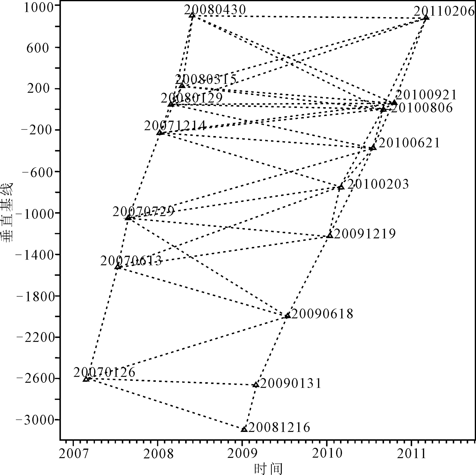
Fig.5 Temporal and perpendicular baselines for interferograms along Xianshuihe Fault

Fig.6 Histogram of LOS velocity of high coherent points along Xianshuihe Fault

Fig.7 Inter-earthquake deformation field of Xianshuihe Fault from 2007 to 2011

Fig.8 Distribution graphs of slipping rate of sections along Xianshuihe Fault
| 剖面线 | 速率 均值 | 北东盘 速率 | 南西盘 速率 | 断层两盘 相对运动 |
|---|---|---|---|---|
| A | -5.21±0.19 | -1.32±0.25 | -10.46±0.42 | 9.14±0.67 |
| B | -4.36±0.37 | -2.12±0.39 | -12.73±0.43 | 10.61±0.82 |
| C | -5.55±0.37 | -4.68±0.25 | -13.33±0.45 | 8.65±0.67 |
| D | -4.18±0.48 | -1.76±0.46 | -11.23±0.61 | 9.47±1.07 |
| E | -4.91±0.30 | -3.43±0.28 | -12.56±0.60 | 9.13±0.88 |
| F | -3.65±0.18 | -1.24±0.17 | -10.64±0.40 | 9.40±0.57 |
| 平均值 | -4.635±0.42 | -2.43±0.30 | -11.83±0.48 | 9.40±0.78 |
Table 2 Parameter estimation of the section rate in Xianshuihe Fault (mm/a)
| 剖面线 | 速率 均值 | 北东盘 速率 | 南西盘 速率 | 断层两盘 相对运动 |
|---|---|---|---|---|
| A | -5.21±0.19 | -1.32±0.25 | -10.46±0.42 | 9.14±0.67 |
| B | -4.36±0.37 | -2.12±0.39 | -12.73±0.43 | 10.61±0.82 |
| C | -5.55±0.37 | -4.68±0.25 | -13.33±0.45 | 8.65±0.67 |
| D | -4.18±0.48 | -1.76±0.46 | -11.23±0.61 | 9.47±1.07 |
| E | -4.91±0.30 | -3.43±0.28 | -12.56±0.60 | 9.13±0.88 |
| F | -3.65±0.18 | -1.24±0.17 | -10.64±0.40 | 9.40±0.57 |
| 平均值 | -4.635±0.42 | -2.43±0.30 | -11.83±0.48 | 9.40±0.78 |

Fig.9 Deformation characteristics and InSAR results of Xialazong landslide

Fig.10 InSAR series graph of Baiyigong landslide

Fig.11 InSAR series graph of Deerwacun landslide

Fig.12 InSAR series graph of Youlong giant landslides

Fig.13 The secondary landslide of Youlong giant landslides
| [1] | 黄润秋. 20世纪以来中国的大型滑坡及其发生机制[J]. 岩石力学与工程学报, 2007, 26(3): 433-454. |
| [2] | 张永双, 石菊松, 孙萍, 等. 汶川地震内外动力耦合及灾害实例[J]. 地质力学学报, 2009, 15(2): 131-141. |
| [3] | 郭长宝, 杜宇本, 张永双, 等. 川西鲜水河断裂带地质灾害发育特征与典型滑坡形成机理[J]. 地质通报, 2015, 34(1): 121-134. |
| [4] | 李天袑, 杜其方. 鲜水河活动断裂带及强震危险性评估[M]. 成都: 成都地图出版社, 1997:1-20. |
| [5] |
ROGER F, CALASSOU S, LANCELOT J, et al. Miocene emplacement and deformation of the Konga Shan granite (Xianshui He fault zone, west Sichuan, China): geodynamic implications[J]. Earth and Planetary Science Letters, 1995, 130(1/4): 201-216.
DOI URL |
| [6] | 许志琴, 李化启, 侯立玮, 等. 青藏高原东缘龙门山—锦屏造山带的崛起-大型拆离断层和挤出机制[J]. 地质通报, 2007, 26(10): 1262-1276. |
| [7] | 黄润秋, 许强. 中国典型灾难性滑坡[M]. 北京: 科学出版社, 2008:1-50. |
| [8] |
GUO C B, DAVID R, ZHANG Y S, et al. Quantitative assessment of landslide susceptibility along the Xianshuihe fault zone, Tibetan Plateau, China[J]. Geomorphology, 2015, 248: 93-110.
DOI URL |
| [9] | 唐小平, 郑万模, 杨学之. 康定白土坎滑坡特征及防治对策[J]. 地质灾害与环境保护, 1999, 10(1): 29-34. |
| [10] | 王东辉, 肖红勇, 李明辉. 滑坡滑前地质模型重建方法与思路——以鲜水河断裂带老虎嘴滑坡为例[J]. 水文地质工程地质, 2013, 40(5): 111-116. |
| [11] | 姚令侃, 邱燕玲, 魏永幸. 青藏高原东缘进藏高等级道路面临的挑战[J]. 西南交通大学学报, 2012, 47(5): 719-734. |
| [12] | 谢谟文, 王增福, 胡嫚, 等. 高山峡谷区D-InSAR滑坡监测数据特征分析[J]. 测绘通报, 2012(4): 18-21. |
| [13] | ACHACHE J, FRUNEAU B, DELACOURT C. Applicability of SAR interferometry for monitoring of landslides[J]. ERS Applications, 1996, 383: 165. |
| [14] | VIETMEIER J, WAGNER W, DIKAU R. Monitoring moderate slope movements (landslides)in the southern French Alps using differential SAR interferometry[M]// International Workshop on ERS SAR Interferometry.Proceedings of the 2nd International Workshop on ERS SAR Interferometry. Fringe’: Liège, 1999: 1-5. |
| [15] |
CARLO C, ALESSANDRO F. Monitoring landslides and tectonic motions with the Permanent Scatterers Technique[J]. Engineering Geology, 2003, 68: 3-14.
DOI URL |
| [16] |
SQUARZONI C, DELACOURT C, ALLEMAND P. Nine years of spatial and temporal evolution of the La Valette landslide observed by SAR interferometry[J]. Engineering Geology, 2003, 68: 53-66.
DOI URL |
| [17] | 霍志涛, 张业明, 金维群, 等. 三峡库区滑坡监测中的新技术和新方法[J]. 华南地质与矿产, 2006(4): 69-74. |
| [18] | 姚鑫, 张永双, 杨农, 等. 玉树地震地表变形InSAR观测及初步分析[J]. 地质力学学报, 2010, 16(2): 129-136. |
| [19] | 钱洪. 鲜水河断裂带上潜在震源区的地质学判定[J]. 四川地震, 1988(2): 20-28. |
| [20] | 张岳桥, 陈文, 杨农. 川西鲜水河断裂带新生代剪切变形40Ar/39Ar 测年及其构造意义[J]. 中国科学(地球科学), 2004, 34(7): 613-621. |
| [21] | 李海兵, 许志琴, 杨经绥. 青藏高原北缘和东缘造山带的崛起及造山机制[M]//许志琴, 杨经绥, 李海滨,等. 造山的高原. 北京: 地质出版社, 2007: 276-294. |
| [22] | 熊探宇, 姚鑫, 张永双. 鲜水河断裂带全新世活动性研究进展综述[J]. 地质力学学报, 2010, 16(2): 102-113. |
| [23] | WEN X Z, JIA J K, PAN M, et al. Recent slip rates, earthquake recurrence intervals and strong seismic hazards on the northwestern segment of the Xianshuihe fault zone[J]. Earthquake Research in China, 1988, 2(4): 432-451. |
| [24] | 白永健, 铁永波, 倪化勇, 等. 鲜水河流域地质灾害时空分布规律及孕灾环境研究[J]. 灾害学, 2014, 29(4): 69-75. |
| [25] | 蒋瑜阳, 唐川, 杨泰平. 鲜水河地震带炉霍段泥石流特征初步研究[J]. 灾害学, 2010, 25(1): 78-83. |
| [26] | 李大虎, 丁志峰, 吴萍萍, 等. 鲜水河断裂带南东段的深部孕震环境与2014年康定MS6.3地震[J]. 地球物理学报, 2015, 58(6): 1941-1953. |
| [27] | 王东辉, 田凯. 鲜水河断裂带炉霍段地震滑坡空间分布规律分析[J]. 工程地质学报, 2014, 22(2): 292-299. |
| [28] | 林邦慧, 陈天长, 蒲晓红, 等. 鲜水河断裂带强震的破裂过程与地震活动[J]. 地震学报, 1986, 8(1): 3-22. |
| [29] | 刘媛媛. 基于多源SAR数据的时间序列InSAR地表形变监测研究[D]. 西安: 长安大学, 2014. |
| [30] | USAI S. A new approach for long term monitoring of deformations by differential SAR interferometry[D]. Delft: Delft University of Technology, 2001. |
| [31] |
USAI S. A least squares database approach for SAR interferometric data[J]. IEEE Transactions on Geoscience and Remote Sensing, 2003, 41(4): 753-760.
DOI URL |
| [32] | FERRETTI A, ROCCA F, PRATI C. Permanent scatterers in SAR interferometry[R]. Hamburg: IGARSS, 1999. |
| [33] |
FERRETTI A, PRATI C, ROCCA F. Permanent Scatterers in SAR Interferometry[J]. IEEE Transactions on Geoscience and Remote Sensing, 2001, 39(1): 8-20.
DOI URL |
| [34] |
BERARDINO P, FORNARO G, LANARI R, et al. A new algorithm for surface deformation monitoring based on small baseline differential SAR interferograms[J]. IEEE Transactions on Geoscience and Remote Sensing, 2002, 40(11) : 2375-2383.
DOI URL |
| [35] | WERNER C, WEGMULLER U, STROZZI T, et al. Interferometric point target analysis for deformation mapping[M]// Proceedings of IEEE International Geoscience and Remote Sensing Symposium Melbourne: IEEE, 2003: 4362-4364. |
| [36] |
MORA O, MALLORQUI J J, BROQUETAS A. Linear and nonlinear terrain deformation maps from a reduced set of interferometric SAR images[J]. IEEE Transactions on Geoscience and Remote Sensing, 2003, 41(10): 2243-2253.
DOI URL |
| [37] | LI Y S, ZHANG J F, LI Z H, et al. Measurement of subsidence in the Yangbajing geothermal fields, Tibet, from TerraSAR-X InSAR time series analysis[J]. International Journal of Digital Earth, 2016 (7): 697-709. |
| [38] |
HOOPER A, BEKAERT D, SPAANS K, et al. Recent advances in SAR interferometry time series analysis for measuring crustal deformation[J]. Tectonophysics, 2012, 514/517: 1-13.
DOI URL |
| [39] | 李永生, 张景发, 李振洪, 等. 高级时序 InSAR 地面形变监测及地震同震震后形变反演[R]. 哈尔滨: 中国地震局工程力学研究所, 2014. |
| [40] | 李永生, 张景发, 李振洪, 等. 时序InSAR离散相干点相位解缠误差检查与校正方法研究[J]. 武汉大学学报(信息科学版), 2014, 39(10): 1199-1203. |
| [41] |
ZEBKER H A, ROSEN P A, HENSLEY S. Atmospheric effects in interferometric synthetic aperture radar surface deformation and topographic maps[J]. Journal of Geophysical Research, 1997, 102:7547-7563.
DOI URL |
| [42] | COSTANTINI M, ROSEN P A. A generalized phase unwrapping approach for sparse data[R]. Hamburg:IGARSS, 1999: 267-269. |
| [43] | 洪顺英. 基于多视线向D-InSAR技术的三维同震形变场解算方法研究及应用[D]. 北京: 中国地震局地质研究所, 2010. |
| [44] |
TAPPONNIER P, MOLNAR P. Active faulting and tectonics of China[J]. Geophysical Research, 1977, 82: 2905-2930.
DOI URL |
| [45] |
GAN W, ZHANG P Z, SHEN Z K. Present-day crustal motion within the Tibetan Plateau inferred from GPS measurements[J]. Geophysical Research, 2007, 112: B08416. doi: 10.1029/2005JB004120.
DOI |
| [46] | 李凌静, 姚鑫, 张永双, 等. 基于PS-InSAR技术的断裂带近场变形特征提取[J]. 地质通报, 2015, 34(1): 217-228. |
| [47] | WANG H, WRIGHT T J, BIGGS J. 用InSAR数据得到的鲜水河断裂西北段地震间滑动速率[J]. 国际地震动态, 2013(3): 8-12. |
| [48] | 屈春燕, 单新建, 张国宏, 等. 时序InSAR断层活动性观测研究进展及若干问题探讨[J]. 地震地质, 2014, 36(3): 731-748. |
| [49] | 谢富仁, 祝景忠, 梁海庆, 等. 中国西南地区现代构造应力场基本特征[J]. 地震学报, 1993, 15(4): 407-417. |
| [50] | 余睿. 基于短基线(SBAS)技术的西和县滑坡监测研究[D]. 南京: 南京师范大学, 2014. |
| [51] |
JONSSON S, ZEBKER H, SEGALL P, et al. Fault slip distribution of the 1999 MS7.1 Hector Mine,California,earthquake estimated from satellite radar and GPS measurements[J]. Bulletin of the Seismological Society of America, 2008, 92(4):1377-1389.
DOI URL |
| Viewed | ||||||
|
Full text |
|
|||||
|
Abstract |
|
|||||