欢迎访问现代地质!

现代地质 ›› 2019, Vol. 33 ›› Issue (01): 56-62.DOI: 10.19657/j.geoscience.1000-8527.2019.01.06

• 构造地质学与地层学 • 上一篇    下一篇

北京大兴凸起南部PGZ05钻孔剖面第四纪磁性地层学

赵勇(), 李瑞杰, 魏波, 王纯君, 孙永华, 方同明   

  1. 北京市地质调查研究院,北京 100195
  • 收稿日期:2018-01-23 修回日期:2018-09-05 出版日期:2019-02-26 发布日期:2019-02-28
  • 作者简介:赵 勇,男,硕士,高级工程师,1983年出生,构造地质学专业,主要从事区域地质及第四纪地质调查研究工作。Email:zhaoyong3068@163.com
  • 基金资助:
    中国地质调查局项目“北京1∶5万琉璃河、庞各庄、安次县幅区域地质调查”(12120114007701)

Magnetostratigraphy of Borehole PGZ05 in Southern Daxing Uplift, Beijing Plain

ZHAO Yong(), LI Ruijie, WEI Bo, WANG Chunjun, SUN Yonghua, FANG Tongming   

  1. Beijing Geological Survey Institute,Beijing 100195,China
  • Received:2018-01-23 Revised:2018-09-05 Online:2019-02-26 Published:2019-02-28

摘要:

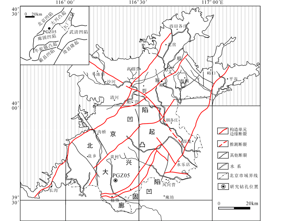
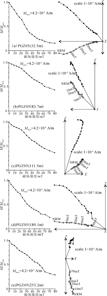
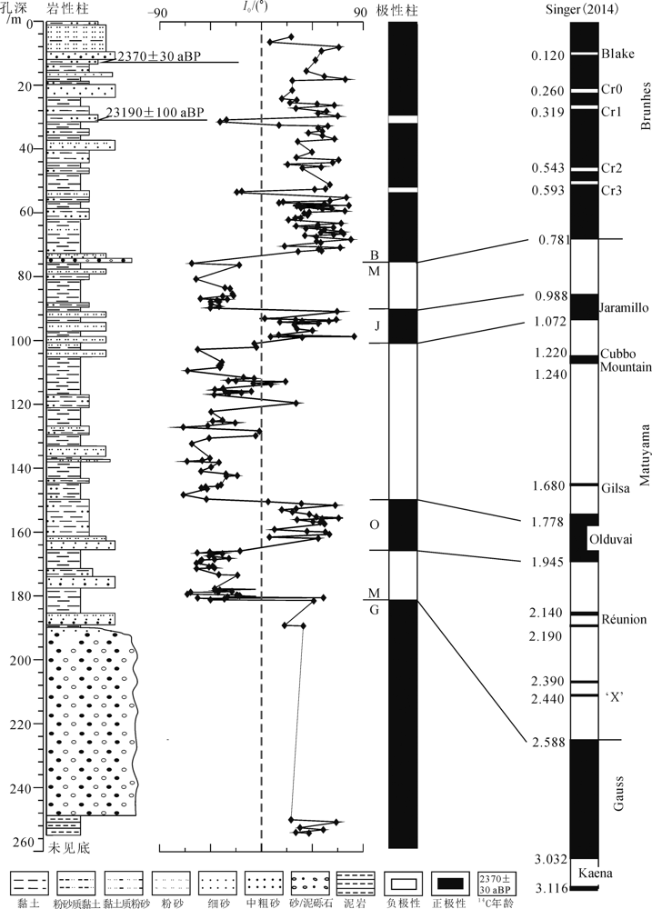
对北京大兴凸起南部PGZ05孔(孔深255 m)全孔岩心进行了磁性地层、岩石地层、AMS14C测年研究,在系统性的古地磁样品采集(440块岩样)、处理和测试基础上,分析认为255 m的岩心记录了布容正向极性时(Brunhes)、贾拉米洛(Jaramillo)极性亚时、奥尔都维(Olduvai)极性亚时和高斯正极性时(Gauss)。在此磁性年代框架上,结合AMS14C测年及岩性特征,对PGZ05钻孔剖面进行第四纪地层划分,确定下更新统、中更新统、上更新统和全新统的分布深度及年代,将更新统的底界(Q/N)定位于181.35 m处,亦为一重要岩性(棕红色半固结黏土)界限,中更新统、上更新统、全新统的底界分别定位于75.60 m、57.20 m、17.35 m处。研究成果为大兴凸起南部第四纪地层划分与对比、古地理环境演变及区域地层研究提供了可靠的地层年代学框架,具有重要地质意义。

关键词: 磁性地层, 第四纪, 大兴凸起南部, AMS14C测年

Abstract:

Quaternary deposits in the southern Daxing uplift in the Beijing Plain provide an important archive for Quaternary stratigraphic changes. Here we present the magnetostratigraphic results of borehole PGZ05 (255 m). A total of 440 undisturbed samples were collected from the borehole at a 0.2-0.5 m interval except for the sand and gravel lay. The results show that the Brunhes/Matuyama and Matuyama/Gauss boundaries occur at 75.60 m and 181.35 m deep, respectively. The Gauss normal polarity chron occurs at 181.35 to 255.00 m deep. The 75.60 to 181.35 m interval is fairly correlative with the Matuyama reversal in the geomagnetic polarity timescale, with two normal polarity zones corresponding to the Jaramillo (90.90-100.60 m) and Olduvai (149.70~165.50 m) subchrons, respectively. The AMS14C age of (2,370±30) a BP and (23,190±100) a BP were obtained from the samples at 12.20 m and 31.45 m deep. The lithologic section of the borehole PGZ05 includes the entire Pleistocene and Holocene sequences and part of the Pliocene sequence. According to the M/G boundary and lithologic section of the borehole, we suggest that the N/Q boundary is located at 181.35 m deep, and it represents an important lithological interface. We propose that the sediments below 181.35 m depth belong to the Upper Pliocene series. The Lower Pleistocene sequence occurs at 75.60-181.35 m deep and were deposited during 0.78-2.58 Ma. The boundary between the Middle and Upper Pleistocene sequence is located at 57.20 m deep, whilst the Holocene-Upper Pleistocene boundary is located at 17.35 m deep.

Key words: magnetostratigraphy, Quaternary, southern Daxing uplift, AMS14C dating

中图分类号: